Home
About
Introduction
Thematic Area
Our Team
Contact
News & Events
News
Press Release
NCDRR
2nd NCDRR
3rd NCDRR
APMCDRR
Photos
Videos
Vacancy & Notice
Current Program
Upcoming Programs
Vacancy
Notice
Online Resource Center
VD Platform
Sphere Nepal
Secretariat & Focal Point
NPDRR
Sphere Geneva
ITP
Resources
Show All
DPNet Publication
General Publication
Situation Analysis Report
Ebulletin
Weekly Report
Legal Document
Koshi Province
Madhesh Province
Bagmati Province
Gandaki Province
Lumbini Province
Karnali Province
Sudurpaschim Province
Important Legal documents
Act
Ordinance
Court Decision
Rules and Regulation
Policy
Strategic Planning
Action Plan
Standards
Guidelines
Framework
Procedure
Circular
Province Level
District Level
Local Level
International Treaties
Sample Legal Document
Book
Hand Book
Journal
Research Paper
Bulletins
Position Paper
Conference Paper
Review Article
Factsheets
Case Studies
Presentations
Training Materials
Flyer, Brochure, Template
Report
Manual
Official Statement
GEDSI
Videos
NCDRR Presentations
Day 1
Day 2
DPNet Bulletin
Useful Links
Contract Directory
Translated - English to Nepali
Translated - Nepali to English
NCDRR 2 Presentations
Event Day 1
Event Day 2
Article
3rd NCDRR Presentations
Day 01 Presentations
Day 02 Presentations
Search
From (year)
To (year)
Search Keyword
Search
Clear
Documents per-page
12 Documents
6 Documents
12 Documents
24 Documents
36 Documents
List of loaded documents (21-36 / 95)
21. GIS-Based Assessment of Debris Flow Susceptibility and Hazard in Mountainous Regions of Nepal
22. Landslide Hazard Zonation, Mapping and Investigation of Triggering Factors in Phewa Lake Watershed, Nepal
23. Landslide Hazard Zonation using GIS: A Case Study from Sindupalchowk Nepal
24. Landslide susceptibility mapping along Bhalubang—Shiwapur area of mid-Western Nepal using frequency ratio and conditional probability models
25. GIS Bases Frequency Ratio Method for Identification of Potential Landslide Susceptible Area in the Siwalik Zone of Chatara, Barahakshetra Section, Nepal
26. GIS Based Landslide Susceptibility Mapping using a Fuzzy Logic Approach: A Case Study from Ghurmi-Dhad Khola Area, Eastern Nepal
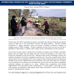
27. International Women's Day 2022 "Gender Equality Today for Sustainable Tomorrow", Story Feature Series
28. Floodplain Analysis and Risk Assessment of Lakhandei River
29. An Integrated Approach to Climate Change Adaptation
30. Catchment-scale Flood Hazard Mapping and Flood Vulnerability Analysis of Residential Buildings: The Case of Khando River in Eastern Nepal
31. Living with Uncertainty: Climate Change and Disasters
32. Increasing Risk of Glacial Lake Outburst Floods as a Consequence of Climate Change in the Himalayan Region
GIS-Based Assessment of Debris Flow Susceptibility and Hazard in Mountainous Regions of Nepal
Read More
Landslide Hazard Zonation, Mapping and Investigation of Triggering Factors in Phewa Lake Watershed, Nepal
Read More
Landslide Hazard Zonation using GIS: A Case Study from Sindupalchowk Nepal
Read More
Landslide susceptibility mapping along Bhalubang—Shiwapur area of mid-Western Nepal using frequency ratio and conditional probability models
Read More
GIS Bases Frequency Ratio Method for Identification of Potential Landslide Susceptible Area in the Siwalik Zone of Chatara, Barahakshetra Section, Nepal
Read More
GIS Based Landslide Susceptibility Mapping using a Fuzzy Logic Approach: A Case Study from Ghurmi-Dhad Khola Area, Eastern Nepal
Read More
International Women's Day 2022 "Gender Equality Today for Sustainable Tomorrow", Story Feature Series
Read More
Floodplain Analysis and Risk Assessment of Lakhandei River
Read More
An Integrated Approach to Climate Change Adaptation
Read More
Catchment-scale Flood Hazard Mapping and Flood Vulnerability Analysis of Residential Buildings: The Case of Khando River in Eastern Nepal
Read More
Living with Uncertainty: Climate Change and Disasters
Read More
Increasing Risk of Glacial Lake Outburst Floods as a Consequence of Climate Change in the Himalayan Region
Read More
Previous
1
2
3
4
5
6
7
8
Next