Search
List of loaded documents (141-180 / 420)
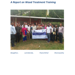
- 141. A Report on Wood Treatment Training
- 142. Repair and Strengthening Guide for Earthquake-Damaged Low-rise Domestic Buildings in Gujarat, India
- 143. Experiences on: Retrofitting of Low-Strength Masonry Buildings by Different Retrofitting Techniques in Nepal
- 144. Seismic Retrofit of Earthquake-Damaged Masonry Housing
- 145. NSET Experience on Seismic Retrofitting of Masonry and RC Frame Buildings in Nepal
- 146. Core Socio-Technical Assistance Package
- 147. Supporting Safer Housing Reconstruction After Disasters: Planning and Implementing Technical Assistance at Large Scale
- 148. Design Catalogue for Reconstruction of Earthquake Resistant Houses
- 149. Roster of Trained Human Resources in Retrofitting of Private Houses in Nepal
- 150. NRA Experience Paper on Retrofitting of Private Housing Post 2015 Gorkha Earthquake
- 151. Gender Equality and Social Inclusion in Disaster Risk Reduction
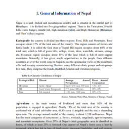
- 152. General Information of Nepal