Home
About
Introduction
Thematic Area
Our Team
Program
Current Program
Recent Success Stories
News & Notice
News
Press Release
NCDRR
NCDRR 2
APMCDRR
Photos
Videos
Notices
Upcoming Programs
Current Openings
Updates
ORC
Virtual Discussion Platform
Sphere Nepal
Contact
Resources
Show All
DPNet Publication
Legal Document
Important Legal documents
Act
Ordinance
Court Decision
Rules and Regulation
Policy
Strategic Planning
Action Plan
Standards
Guidelines
Framework
Procedure
Circular
Province Level
District Level
Local Level
International Treaties
Sample Legal Document
Book
Hand Book
Journal
Research Paper
Bulletins
Position Paper
Conference Paper
Review Article
Factsheets
Case Studies
Presentations
Training Materials
Flyer, Brochure, Template
Report
Manual
Official Statement
GESI
Videos
NCDRR Presentations
Day 1
Day 2
DPNet Bulletin
Useful Links
Contract Directory
Translated - English to Nepali
Translated - Nepali to English
NCDRR 2 Presentations
Event Day 1
Event Day 2
Article
Search
From (year)
To (year)
Search Keyword
Search
Clear
Documents per-page
12 Documents
6 Documents
12 Documents
24 Documents
36 Documents
List of loaded documents (41-60 / 106)
41. Manifestation of an Analytic Hierarchy Process (AHP) Model on Fire Potential Zonation mapping in Kathmandu Metropolitan City, Nepal
42. Immediate Lessons from the Nepal Earthquake
43. Forest Fire Risk Mapping using GIS and remote sensing in two major Landscapes of Nepal
44. Forest fire occurrence, distribution and future risks in Arghakhanchi district, Nepal
45. Factors Affecting Collective Action for Forest Fire Management: A Comparative Study of Community Forest User Groups in Central Siwalik, Nepal
46. Building ex ante resilience of disaster-exposed mountain communities: Drawing insights from the Nepal earthquake recovery
47. A consistent Global Approach for the Morphometric Characterization of Subaqueous Landslides
48. Landslide Susceptibility Mapping using Certainty factor, Index of Entropy and Logistic Regression models in GIS
49. Landscape, Livelihoods and Risk Community Vulnerability to Landslides in Nepal
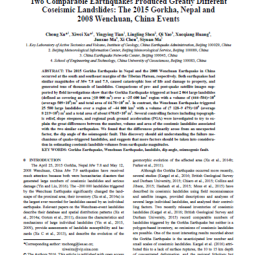
50. Two Comparable Earthquakes Produced Greatly Different Coseismic Landslides: The 2015 Gorkha, Nepal and 2008 Wenchuan, China
51. Trends in landslide occurrence in Nepal
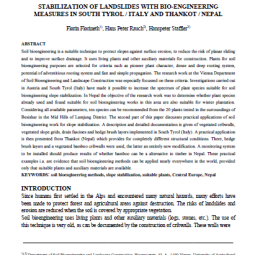
52. Stabilization of Landslides with Bio-engineering measures in south Tyrol / Italy and Thankot / Nepal
Manifestation of an Analytic Hierarchy Process (AHP) Model on Fire Potential Zonation mapping in Kathmandu Metropolitan City, Nepal
Read More
Immediate Lessons from the Nepal Earthquake
Read More
Forest Fire Risk Mapping using GIS and remote sensing in two major Landscapes of Nepal
Read More
Forest fire occurrence, distribution and future risks in Arghakhanchi district, Nepal
Read More
Factors Affecting Collective Action for Forest Fire Management: A Comparative Study of Community Forest User Groups in Central Siwalik, Nepal
Read More
Building ex ante resilience of disaster-exposed mountain communities: Drawing insights from the Nepal earthquake recovery
Read More
A consistent Global Approach for the Morphometric Characterization of Subaqueous Landslides
Read More
Landslide Susceptibility Mapping using Certainty factor, Index of Entropy and Logistic Regression models in GIS
Read More
Landscape, Livelihoods and Risk Community Vulnerability to Landslides in Nepal
Read More
Two Comparable Earthquakes Produced Greatly Different Coseismic Landslides: The 2015 Gorkha, Nepal and 2008 Wenchuan, China
Read More
Trends in landslide occurrence in Nepal
Read More
Stabilization of Landslides with Bio-engineering measures in south Tyrol / Italy and Thankot / Nepal
Read More
Previous
1
2
3
4
5
6
7
8
9
Next