Search
List of loaded documents (161-204 / 370)
- 161. Reducing Risks, Enhancing Resilience
- 162. Nepal: A year after the Earthquakes (A Spotlight on Nepali Women and Girls, their Stories and Their Solutions)
- 163. Migration and the 2015 Gorkha Earthquake in Nepal; Effect on Rescue and Relief Processes and Lessons for the Future
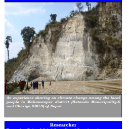
- 164. Impacts Assessment and Climate Change Adaptation: Strategies in Makawanpur District, Nepal
- 165. Evaluation of the River Basin Programme in Nepal
- 166. Living with Uncertainty: Climate Change and Disasters
- 167. Increasing Risk of Glacial Lake Outburst Floods as a Consequence of Climate Change in the Himalayan Region
- 168. Earthquake Resistant Houses in Nepal: A Demonstration Model for Tri-Agency Region Project Completion Report
- 169. Proceedings of the Annual Dialogue on the Koshi Disaster Risk Reduction Knowledge Hub, 2021
- 170. Leveraging Collaboration for Disaster Risk Reduction in the Koshi Basin
- 171. Disaster Risk Understanding of Local People after the 2015 Gorkha Earthquake in Pokhara City, Nepal
- 172. Analyzing the Disaster Response Competency of the Local Government Official and the Elected Representative in Nepal